Last month’s image drew 23 comments, but only three (Dave Fownes, Kim Lunman and Pamela Lyon) were able to correctly identify the scene. It looks downstream with Princess Island in the foreground, Raleigh next and the faint outlines of Savage and Green barely visible in the fog beyond.

Princess is one of the jewels of the River. Apart from the collapsed remains of a small artist’s studio and an ancient shed from a long-gone commercial fisherman who once kept a pen of live sturgeon here, this is one of the very few islands to remain in a pristine, undeveloped state.
It’s also home to a tree which to me exemplifies how some species manage to adapt to survive in the challenging environment of these rugged but very beautiful granite worlds. A white pine grows out the side of a cliff here to a height of at least 25 feet, despite not having one molecule of earth to nurture its roots. Several pitch pines (Canada's rarest) on the southern side also prosper on very little more.
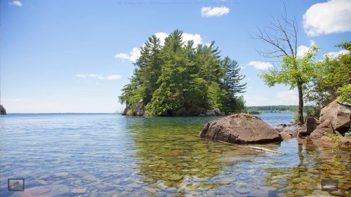
I’m going to stick with last month's summer theme for this month’s image, but replace fog with the warm sunshine that I’m hoping is on its way. Please don’t be shy if you can identify the location and share any stories about the River this may bring to mind.
Enjoy,
Ian Coristine

Download wide-angle version
Comments
I would say it is in the archipelago outside Stockholm
Ann Molnar posted on: Saturday, March 01, 2014
SURE
George Textor posted on: Saturday, March 01, 2014
Interesting and enticing in the sunshine!! As 'art'-- I would likely also appreciate the stunning mood and feeling of the original as 'actually' taken in the fog showing the solitary reflective scene of Island
Joan Ritchie, Windward posted on: Saturday, March 01, 2014
Good, Ann. Maybe, maybe, maybe ... Hebrides? Ian: you need to challenge us/me with something from A B O V E the bridge, hear (you saving gas)? We good there (Canadian side). Especially in Lake Fleet group. Anyway- looks like way wide water, but not THE, 'Wide Waters' where "Forty-Acre" shoal lies. Hmm? Too, we don't have so much flat rocks in the water- on a 'beach-shallows' like this picture of yours shows. But there are flat rocks toward Lake Ontario. Maybe this view is from egress from 'Back Channel" (west end) looking somehow toward Wolfe- see green spar (significant marker) and a water tower way, way away on the horizon to the right of the spar .. or I will be forced to throw my vote in with Ann as to Baltic. Nice island- high- a prerequisite for any island and lots of green! Gosh, sturdy traditionally constructed dock, as well. Indebted here to you, Ian.
rafter Jack Patterson, Axeman Island posted on: Saturday, March 01, 2014
I think it's in the Admiralty, looking West with Wolfe on the left and Howe on the right. I can't pin down exactly which island it is. Doesn't look like Mermaid, and seems too small to be Aubrey. I'll go find it on my jet ski in about 3 months.
Dave Montrois posted on: Saturday, March 01, 2014
If I've got this right, you are one tricky devil Ian! I think this is taken from an island that's unnamed on my charts. It's looking west, towards Aubrey, which you've managed to completely obscure with this angle. This island is also unamed as far as I can tell. I believe that's the extreme west end of Burnt Island on the left, and the green spar marks Tin Cap Shoal. Howe in the background right, and Wolfe on the left. Again, very tricky, because this image had to be made before the oh-so-beautiful :-( wind farm blighted the western horizon! As to that horizon, mentioned by my cousin Rafter Jack--I'm still looking for the water tower he claims to see there! Too much time in the rafters, maybe?
Scott Ritson posted on: Sunday, March 02, 2014


